| Forecast Parameters | CSU Forecast for 2026* | Average for 1991-2020 |
|---|---|---|
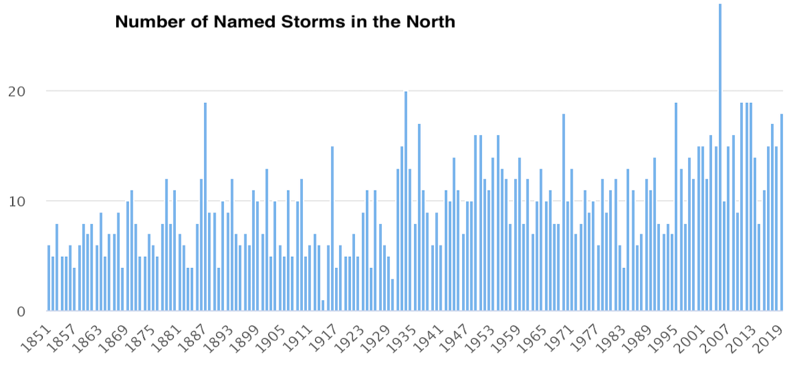
| Named Storms | 13 | 14.4 |
| Named Storm Days | 55 | 69.4 |
| Hurricanes | 6 | 7.2 |
| Hurricane Days | 20 | 27.0 |
| Major Hurricanes | 2 | 3.2 |
| Major Hurricane Days | 5 | 7.4 |
| Accumulated Cyclone Energy (ACE)+ | 90 | 123 |
| ACE West of 60 degrees longitude | 50 | 73 |
| *CSU's initial seasonal forecast for 2026 was released on Thursday, April 9th. | ||
| +A measure of a named storm's potential for wind and storm surge destruction defined as the sum of the square of a named storm's maximum wind speed (in 104 knots2) for each 6-hour period of its existence. | ||
2026 Forecast Summary
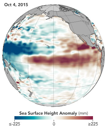
We anticipate that the 2026 Atlantic basin hurricane season will have somewhat below-normal activity. Current weak La Niña conditions are likely to transition to El Niño in the next few months, with the potential for a moderate/strong El Niño for the peak of hurricane season. Sea surface temperatures in the western tropical Atlantic are warmer than normal but slightly cooler than normal in the eastern and central tropical Atlantic. We anticipate El Niño being the dominant factor for the upcoming hurricane season, driving increased levels of tropical Atlantic vertical wind shear. We are forecasting a below-average probability for major hurricane landfalls along the continental United States coastline and in the Caribbean. As with all hurricane seasons, coastal residents are reminded that it only takes one hurricane making landfall to make it an active season. Thorough preparations should be made every season, regardless of predicted activity.
CSU's initial seasonal hurricane forecast and press release for 2026 was released on Thursday, April 9, 2026. The forecast includes predictions for named storms, hurricanes, major hurricanes, and accumulated cyclone energy for the 2026 Atlantic hurricane season. Additional forecast updates will be released on June 10th, July 8th, and August 5th.
See a StoryMap description of our forecast here: StoryMap
Forecast Press ReleaseLea nuestro resumen de pronóstico en español aquí
For full forecast document click the 2026 FORECAST (APRIL 9, 2026) button below.
2025 Season Review
The 2025 Atlantic hurricane season was an above-normal season with 13 named storms, 5 hurricanes, and 4 major hurricanes. Three hurricanes reached Category 5 intensity (Erin, Humberto and Melissa). See the archive page for full details on the 2025 season.
Read our 2025 forecast verification summary hereRead the full 2025 forecast verification here